March 18 2002
Mapping Underground
Stone Churches
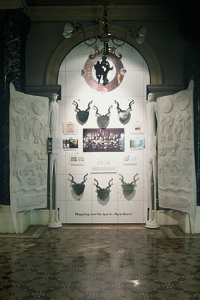
Apartheid Map
Slavery Map
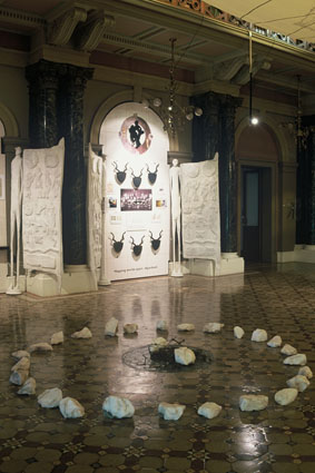

The Queen’s Hall in the NCOP building has been identified as the exhibition space for the initial aspect of the PMP exhibition to open 18th March 2002.
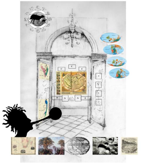
The exhibition has been visualised to engage with and accept the European nature of the architecture at Parliament. Instead of fighting to overpower the architecture, the exhibits will subtly adapt itself to the architectural components of this space (the niches, columns, etc) but impose an African design ethic onto the space. This is a conscious choice that reflects the nuances of changing perception. This subtext - of the physical use of objects and mounting in the exhibit - will be the fundamental building block in exposing the hidden meaning of the maps. It will help to reveal what is silent in the maps. For the viewer, it will hold the information about the fundamental premise of the exhibit - to reveal what is unsaid, to create a new language which is quintessentially South African, and to re-contextualise that which is accepted.
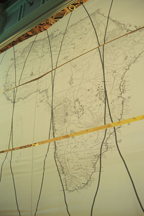
The majority of the maps reveal a Western perception of the world. This viewpoint centers around control, power, individual ownership of land, demarcation of boundaries, and imposition of political will. In contrast, the indigenous peoples of Southern Africa did not have a concept of individual ownership of land. Land was understood in terms of resources; families and groups were mapped through symbols and images in artwork belonging to a larger whole. The San people used mapping of the sky and earth to understand where hunting grounds were, or to map where important resources were located. Ephemeral maps that did not survive save for the oral traditions of a few survivors.
The display ‘cabinets’ and doors which form the central components of the exhibit , show an African way of looking at the world that is very different from the European two-dimensional, linear way of seeing. An African way of seeing as a multi-dimensional map of the person/family/society, how they sit in the world in reference to their land, their resources, the earth, the sky, their social identity, and their political power. Maps that came before colonial times were maps that told historical and political stories overtly through symbols that everyone reading them understood, rather than subvertly as on the European maps. The juxtaposition of these ways of seeing form the basis of the exhibition.
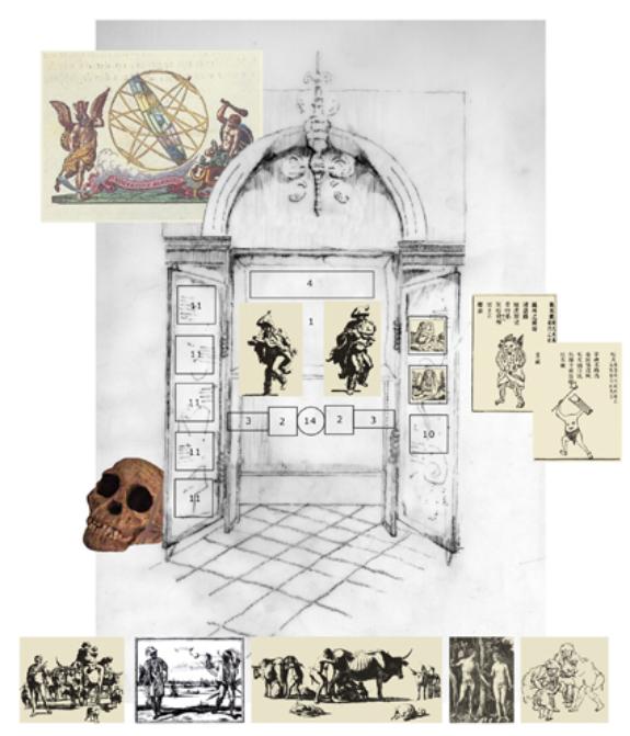
( The italic text hereafter represents the initial visualization of the entrance to the exhibition. This has been left in the proposal as an option for the future or possible inclusion for the March exhibition depending on the budget and time available.)
The viewer of the exhibits will enter through an anti-chamber, which will be designed so that the entrance into the main exhibit hall will be an ritualistic process that negotiates the body in space and changes perceptions and location. It will assist the viewer in establishing a rhythm of sight. The portal will consist of an anteroom and a door through which the viewer must pass to get to the main section of the exhibit.
The ante-room will establish certain key concepts. These include:
How we view things depends on where we stand - illuminated by a large landscape painting on three walls depicting Table Mountain viewed from Robben Island thus making the link from Robin Island to Parliament.
The tools we use determine what we create and how we see. A very large paper and wire helix has been visualised in the central anti-chamber before the entrance to the main exhibition hall which the viewer will have to walk around to enter the main exhibition space. This will refer to the human genome project and will have attached to it traditional and contemporary tools of cartography.
There are many ways of mapping the world over and above the conventional means - we must open our eyes to see it. This will be shown in the beaded curtain which hanging in the main doorway to the exhibition hall, and can be strung to quote phrases from the President's "I Am an African" mapping speech, as well as possible the aural sound of indigenous and South African voices telling stories and mapping their world through sound.
The ground floor, will hold seven mounted exhibit spaces, engaging with various themes of historical mapping and seeing.
Each exhibit space will house a ‘display case’ with a companion object i.e. a paper and wire constructed door which will function as a thematic object covering African ‘mapping’ symbols represented visually in wire forms e.g.
Zulu base zigzag or water/ geometric stone engraving from Blombos cave
Crocodiles and snakes are a ancient and consistently used symbol of progenitor, land
Lizards in earth and spirit
Chicken as a part of daily life and humor
Figural symbols for a Parliament of People (women and men)
Xhosa pattern of stars
San spirals representing the sky, heavens, sun
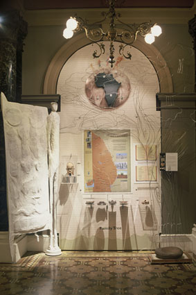
All the doors will be exactly the same. This will ensure that the viewer interconnects the varied displays. However, each display will utilise the doors in an innovative and different way. Again, this process challenges the way we perceive objects in that a singular piece can be re conceived and reinterpreted in many different ways. The doors will form a screen, a cabinet, a triptych, and will be used to hide and reveal.
These displays will all be housed within the architectural niches already present in the exhibition space of the Queens Hall. This establishes a pattern of utilising existing space, while at the same time ensuring that it is adapted to an African, and South African, viewpoint. The exhibition space itself will be lit by the exhibits themselves, through neon lighting illuminated from within the doors. This will subdue the columns and grandiose architecture of the space, but will also reflect the internal illumination of seeing things in an fresh way.
At the center of each display will be map/s originating from the colonial or pre-colonial eras selected form the Parliament collection. These maps will be juxtaposed against objects, sounds, images and words and will innovatively expose the perceptions and preconceived ideas inherent in the maps but representing the African content of the exhibit.
Themes: (The titles of the following themes listed below are for working and reference only at this stage.)
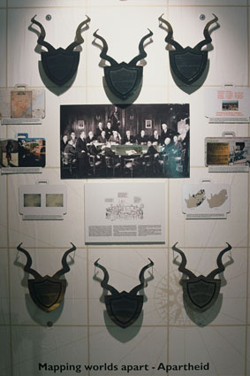
1. The Apartheid Legacy
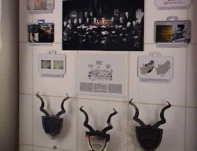
This theme will flow from the painting titled “The First Cabinet of the Republic of South Africa, in Session” which is in the Parliamentary collection. Through a annotated form of display the individuals in the painting will be identified and certain of the policies will be selected to expose their effects in the present day South Africa.
Also useful here could be:
TRC map of apartheid atrocities
An apartheid era AA map with only white areas shown
A map of telecommunications/internet usage - same distribution
A poverty map
A water resource map
2. The Breakwater Map
The theme here will stem from a simple map drawn for the construction of the breakwater in Table Bay. Possible connection to build this theme may be:
- European boundary built in the natural harbor
- Projections and mapping with straight lines thus cutting of the ‘natural’ flow of resources.
- The idea that resources and property resides in the individual compare to the idea that resources are shared.
- The San dot maps - the center is always the point of departure (in this case the water hole) the satellite maps used for the land claims of the San people.
- The Bleek and Lloyd story - language, oral tradition, myths and conservation of heritage
- Reference to the on going debate of the Bushman Diorama.
- Migrancy - Lukasa memory boards - tracking
3. The Family Tree (A Sense of Place)
- What’s in a name - naming as mapping
- Shaka Zulu’s lineage
- The tree as the holder of heritage - refer to the N/u maps of trees and their function in mapping
- Slaves names showing origins
- Loss through obliteration of indigenous names of peoples and places by colonisers - naming as colonising
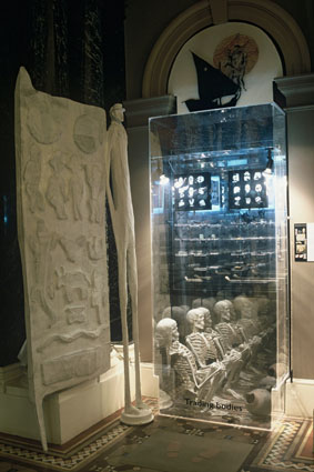
4. Slavery (Roots and Routes)
- Slave factory maps from the Parliament collection - these maps deconstruct themselves and a annotated display will reveal their content.
- The slave lodge will be closely consulted to develop this theme.
- New Slavery map.
5. Trade (Visions of Africa)
- Christendom maps from Parliament collection.
- Muslim slave raids.
- Mapungubwe
- Ming pottery
- Beads
- Patriarchy and war - the feminine/famine side
6. The Physical Shaping of Africa (Forced Perspectives)
- Cartography issues - projection/grids/satellite
- Chinese map/ Upside down map of Africa/ Terra incognita etc (the construction of Africa by the outside world)
- Holbine’s “The Ambasadors” deconstructed to show acquisition policy
7. The Cultural Shaping of Africa
- Pliny’s monstrous races - the idea of an alien
- The construction of the face of the aboriginal peoples of Southern Africa on maps, mapping and the influence of the invention of the printing press and dissemination of information.
- The creation of the face of the ‘Savage’ - the perspective of the European mind.
- The construction of identity up to the present e.g. the construction of the image of the San for the Tourist industry.
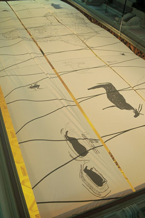
A sail map will be strung over the divide of the ceiling across the balcony level which will darken the exhibition space, cutting down on natural light, making the displays themselves the focal point of illumination. The ceiling, which will be an extraordinarily sophisticated celestial map as represented by the San people. The sail map will reflect the solar calendar in the celestial maps of the San. This map will reveal the sophistication of the indigenous peoples of South Africa, literally mantling the entire space with a multi-layered map of their creation.